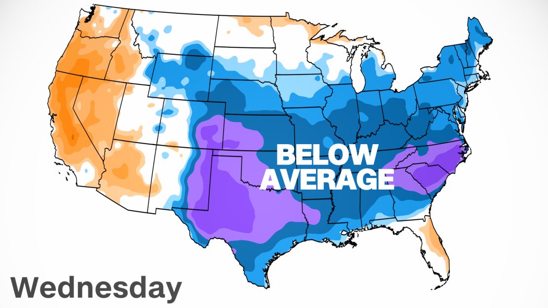
With the official start of summer just 39 days away, an unseasonably cold air mass is gripping a large area of the southeastern US, dropping temperatures 10 to 25 degrees below seasonal averages.
For parts of the South, these temperatures are more in line with what you should expect in mid-March, not mid-May.
From Wednesday into Thursday, as many as 32 record cold high temperatures are expected across the southern US.

South Carolina’s capital city of Columbia is in for a wet and historically cold Wednesday. The city whose slogan is “Famously hot, surprisingly cool,” will experience a different kind of “cool.”
The average high on May 12 in Columbia is 83 degrees, but Wednesday is set to be one of the coolest May afternoons with temperatures in the 50s.
If the 25-degree departure from the norm is not impressive enough, consider that the previous cold record for the date has been standing for over 100 years (66 degrees on May 12, 1917). That record will continue to stand as the midnight temperature in Columbia was 70 degrees, which will be the official high temperature recorded – not much comfort to those shivering through the day.
May high temperatures in the 50s for Columbia are so rare that they have only been observed five times since 1887. Such temperatures in May only come around on average about once every 30 years.
Not far away in Augusta, Georgia, the city is set to break its daily record which has been standing since Grover Cleveland was the commander in chief back in 1885. The high is forecast to reach only 64 degrees in Augusta, nearly 20 degrees below May averages.
Head north to Atlanta and one would expect to be greeted by 80 degree heat in mid-May. However, highs on Wednesday and Thursday are forecast to reach only the lower 60s in “Hotlanta,” 20 degrees below seasonal averages.
Since 1950 there have only been 10 days this late in the season that have failed to reach 65 degrees in Atlanta, with a record of 62 degrees in jeopardy on Thursday.
The coastal cities of Charleston, Savannah and Jacksonville are all expecting record cold afternoons on Thursday as well, as highs are only forecast to reach the middle 60s. Records here have been standing since the early 1900’s.
Why so cold?
The perfect ingredients have combined to create this unusually cool spell across the southern US.
First, a strong area of high pressure has developed across the Upper Midwest, allowing for cool northerly air to filter south toward the Gulf Coast.
This cooler air is supported by a phenomenon known as “cold-air damming” or a “wedge” – when a cold air mass becomes trapped, or “dammed’ by mountains.
A pesky frontal boundary that has led to historic rains in parts of Louisiana this week is shifting to the south and east on Wednesday and Thursday. This front will help trap cooler air against the Appalachians, a mountain range that can act as a dam, keeping the cold air bottled up while the rain continues to fall.
Combine the air flow coming from the north and you have the recipe for a historically cold temperatures for the month of May.
The warm up
If you’re a fan of these cooler temperatures in May, you’ll want to maximize leaving those windows ajar while you can.
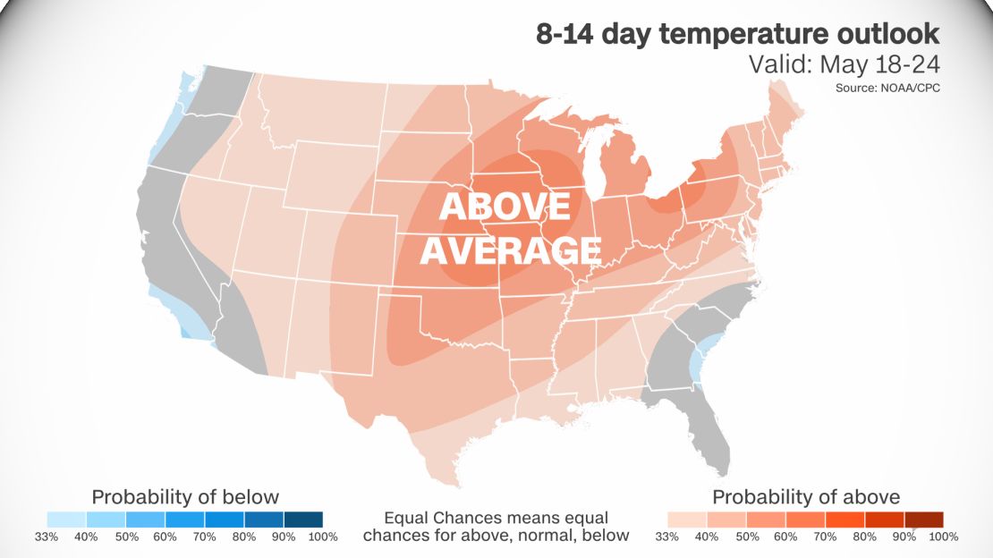
Forecast models agree that the high pressure responsible for the cool northerly air will gradually shift from the Midwest toward the southeastern coastline by this weekend. This will not only allow for clear skies to return to the region, but also the warm southerly air that millions in the South have come to expect in May.

High’s by this weekend will climb back into the upper 70s and further warming into the mid- and upper 80s are expected by the following weekend.
High temperatures in the 50s and 60s would not usually be expected to return across the South until November into December.

