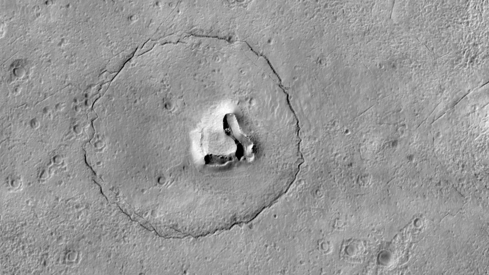
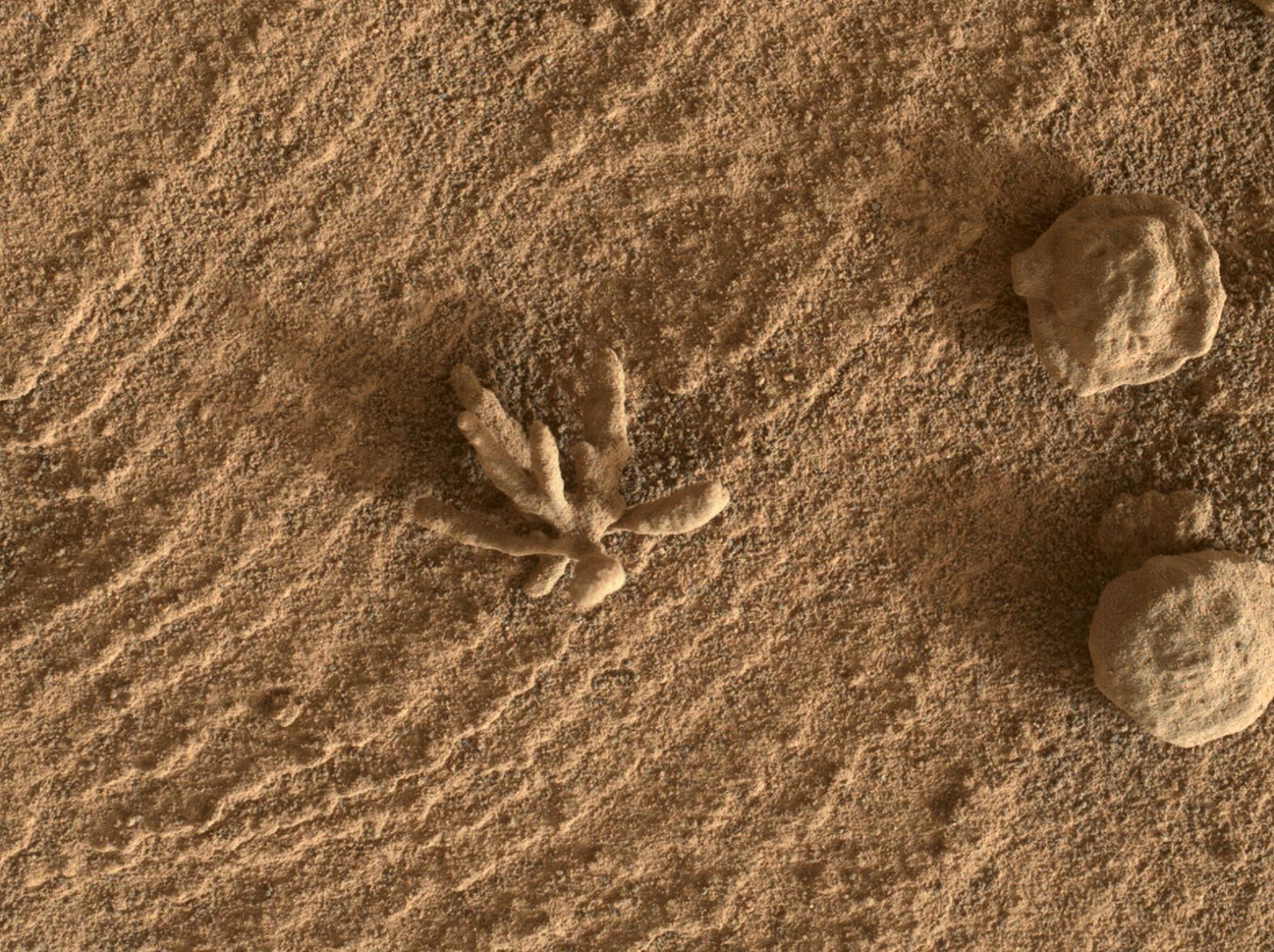
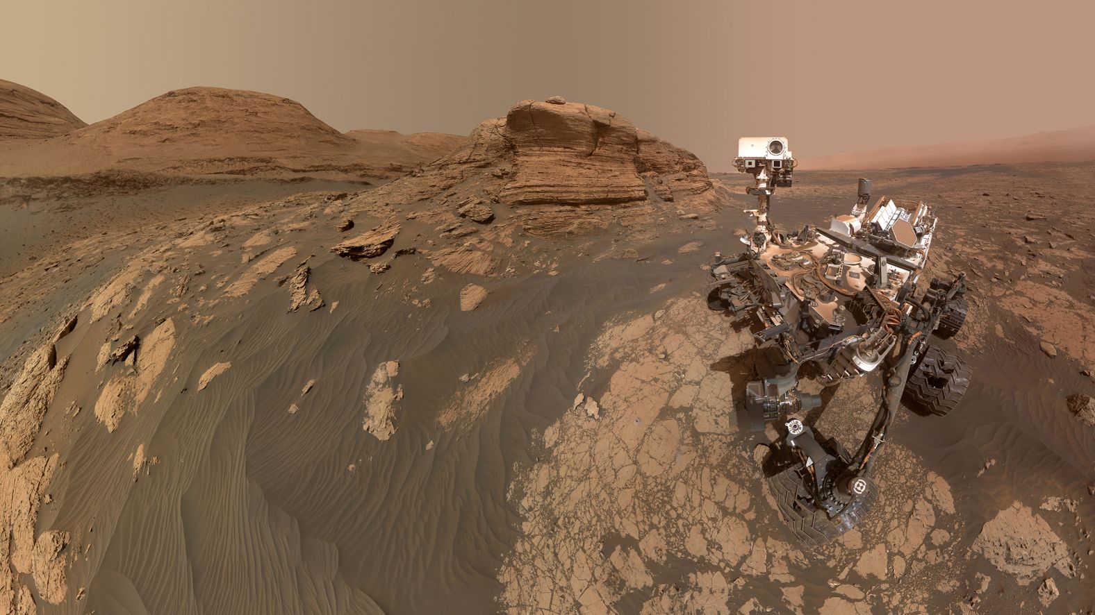
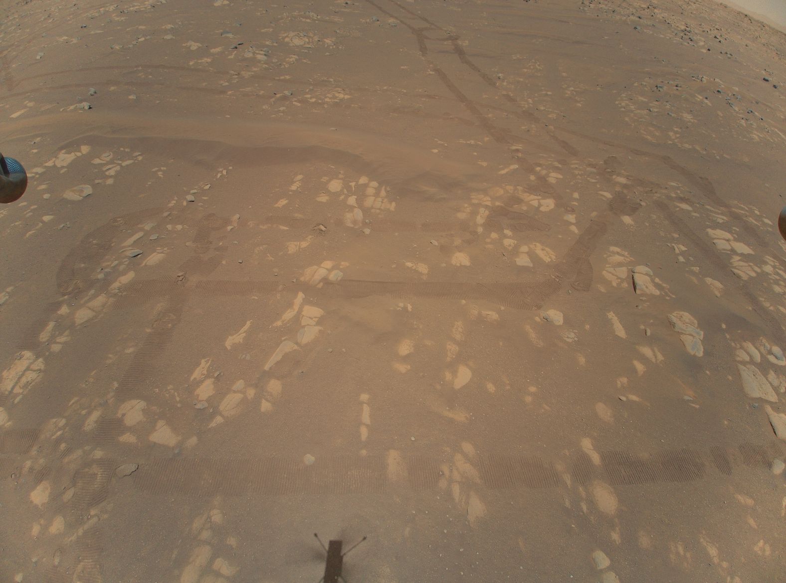
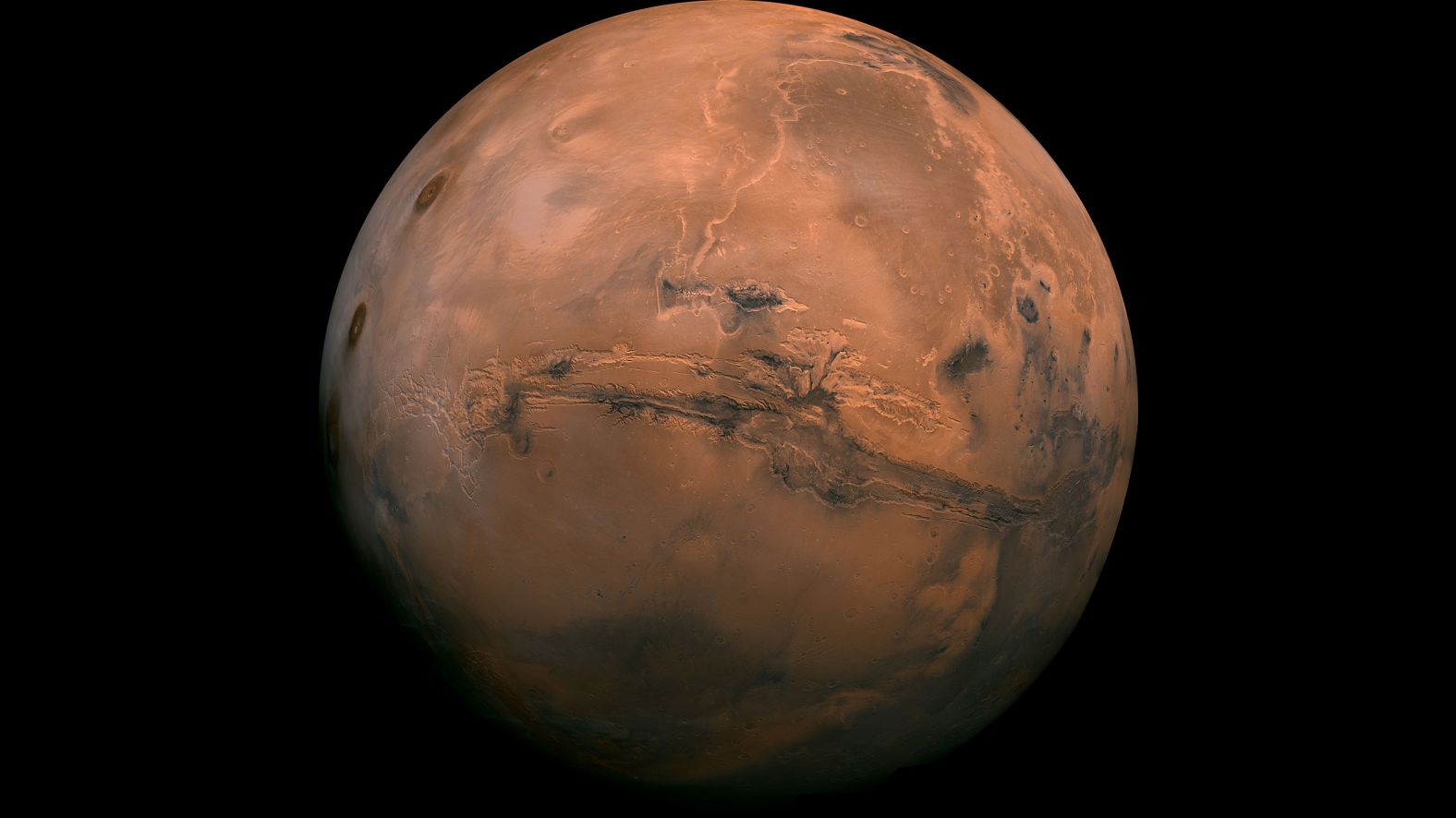
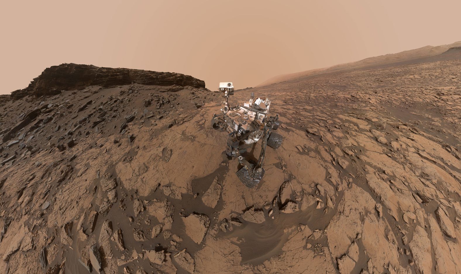
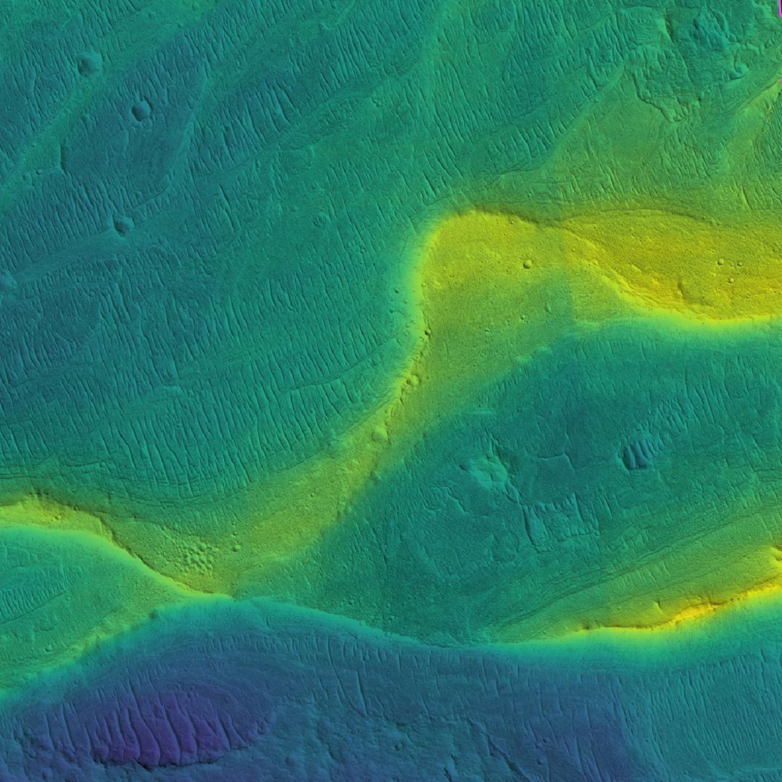
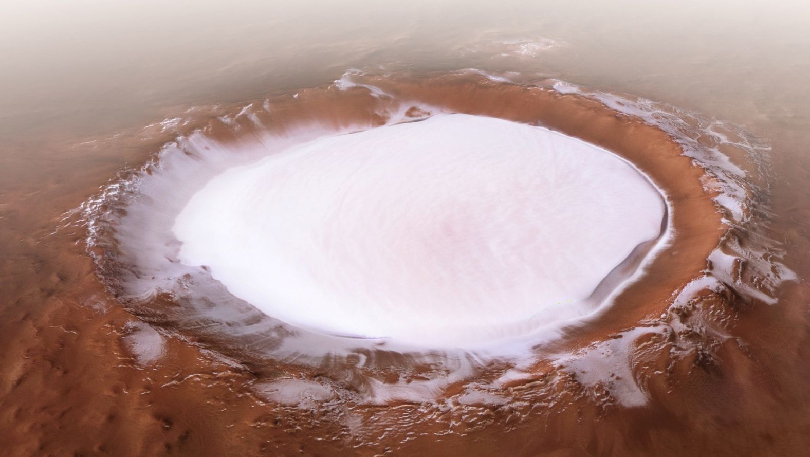
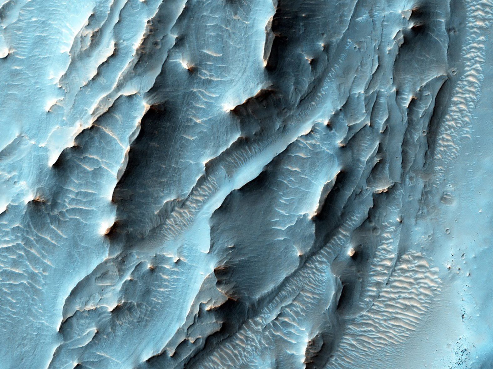
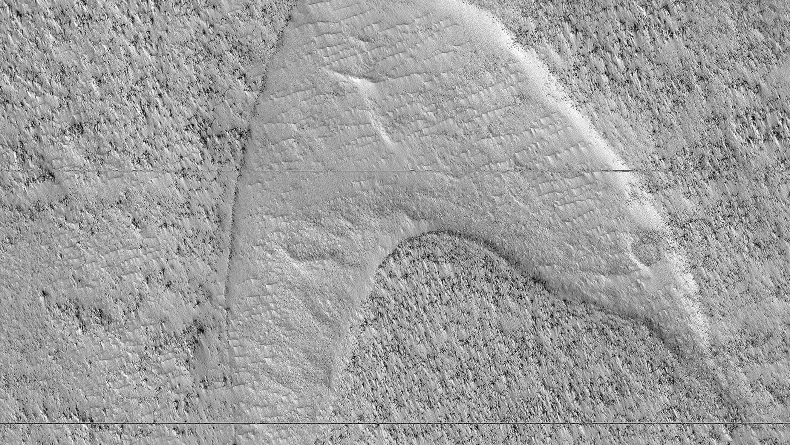
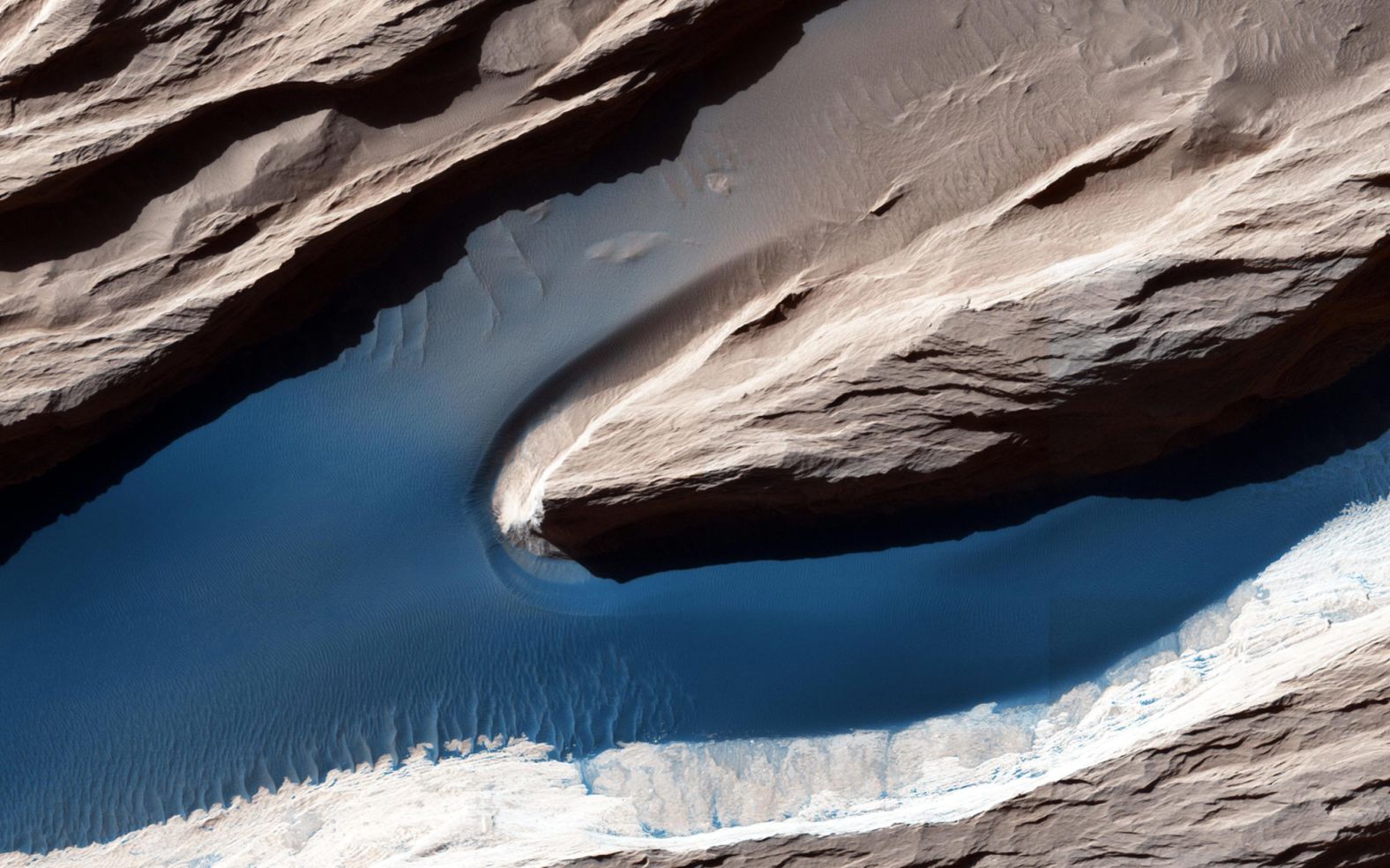
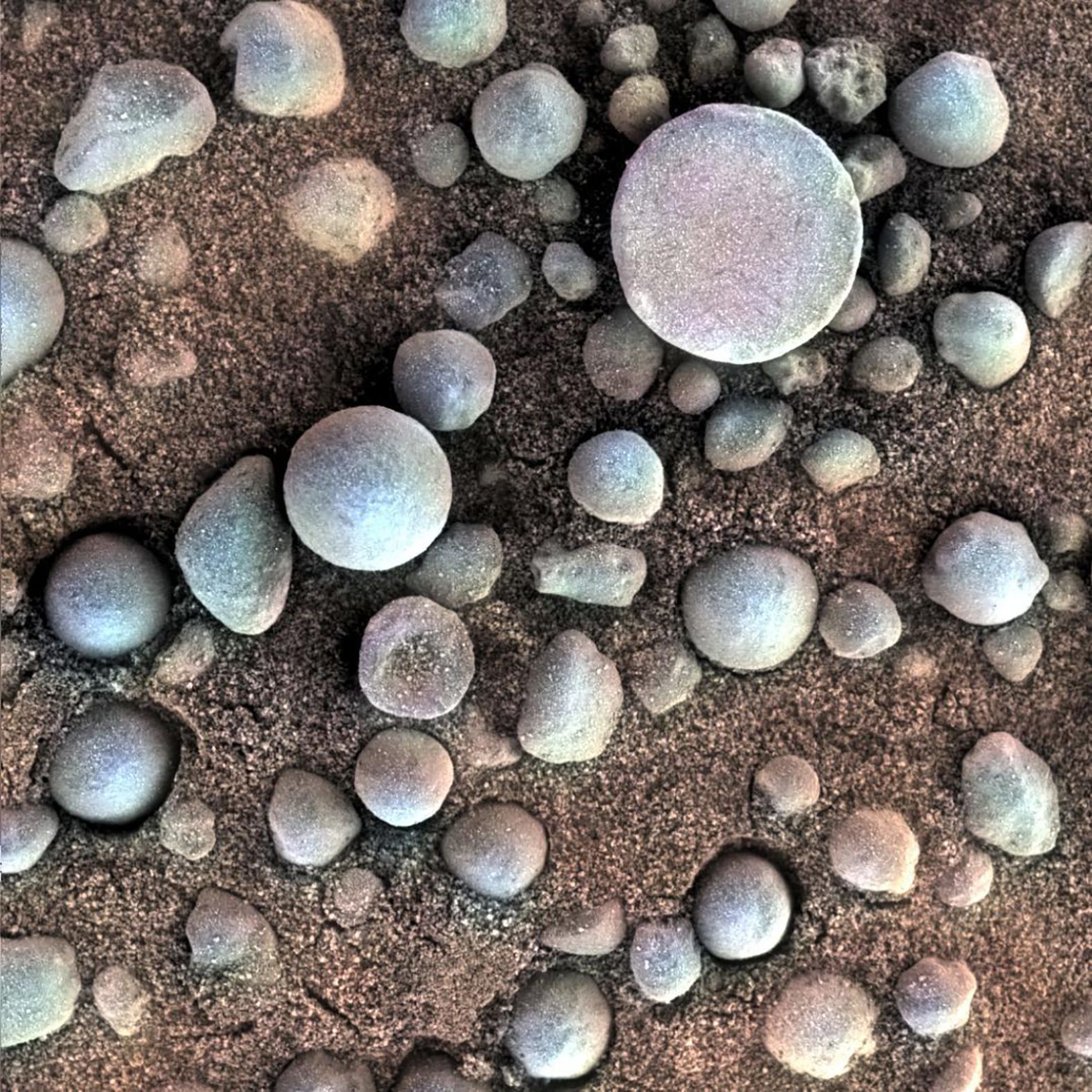
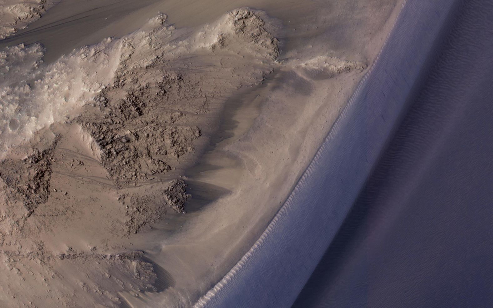
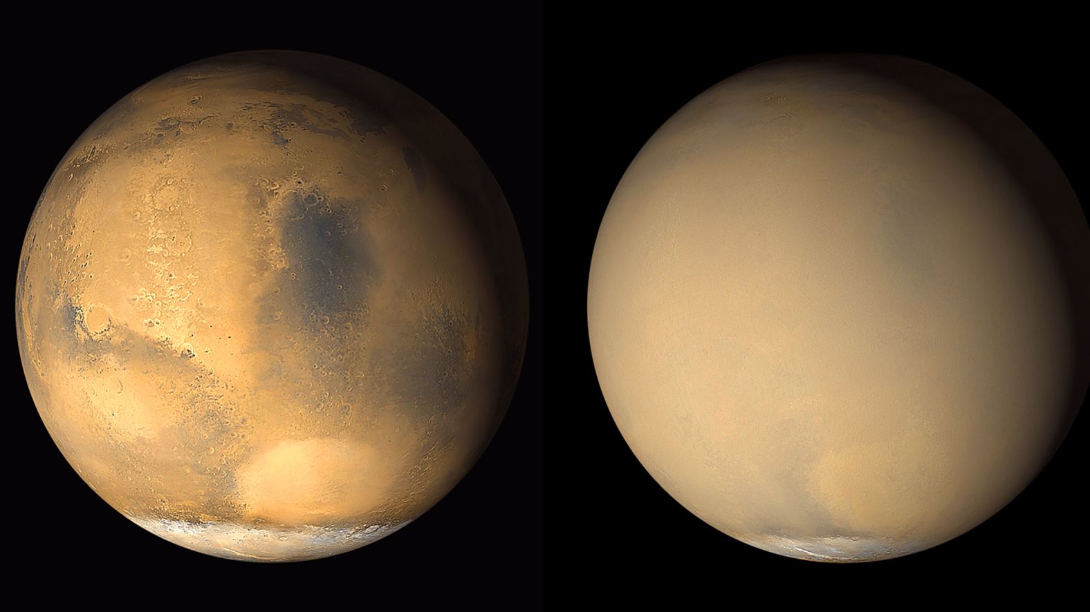
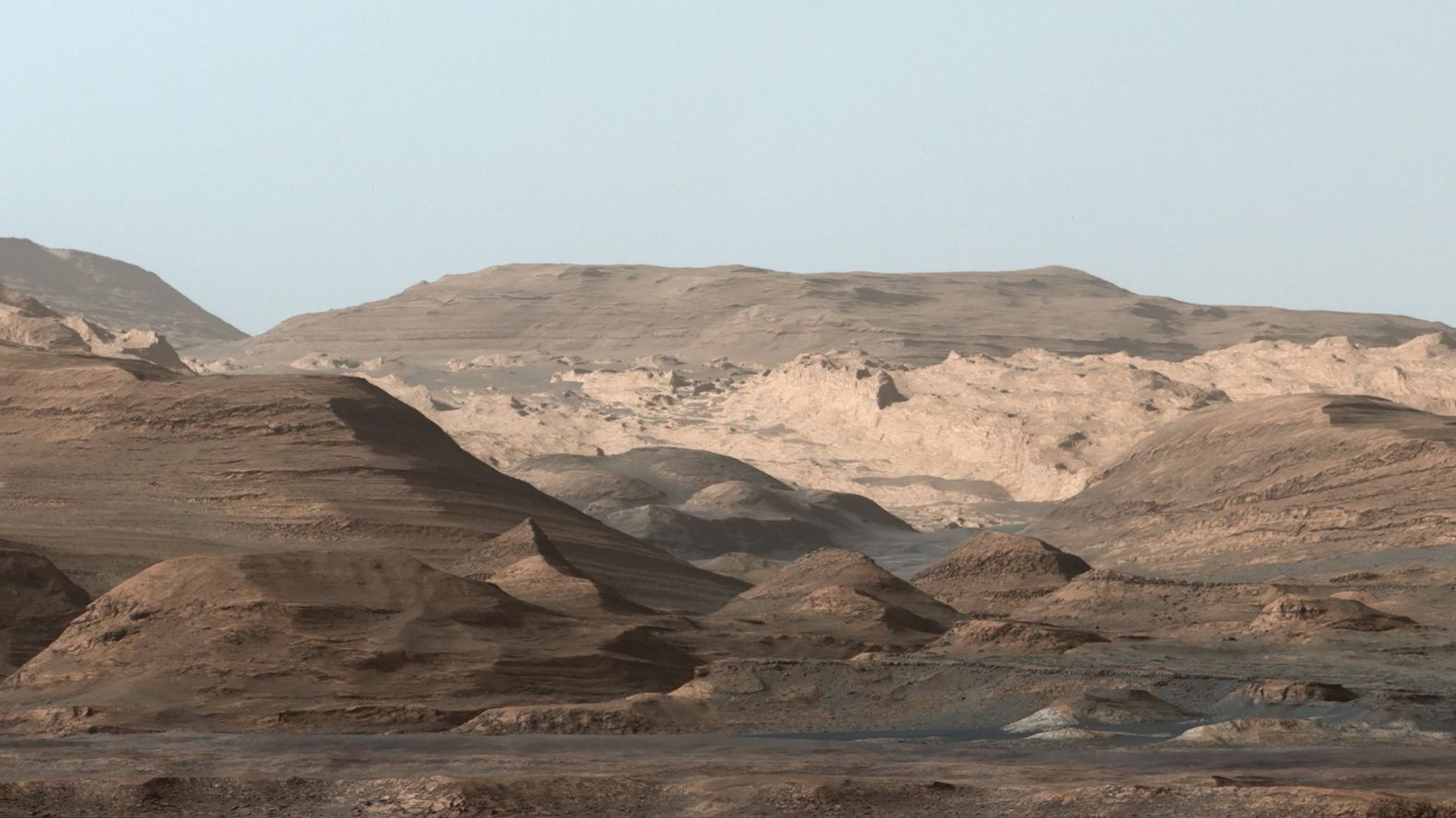
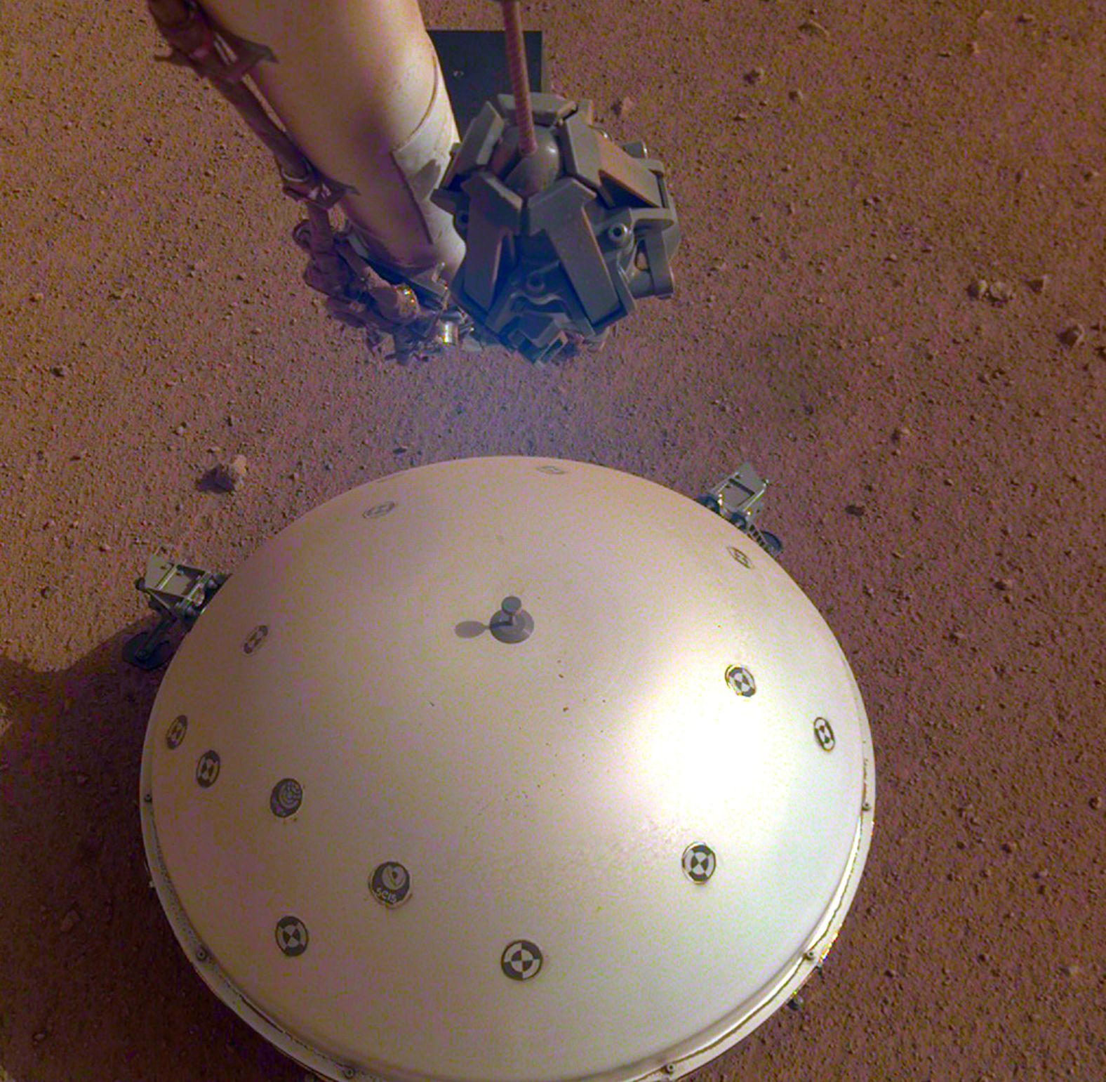
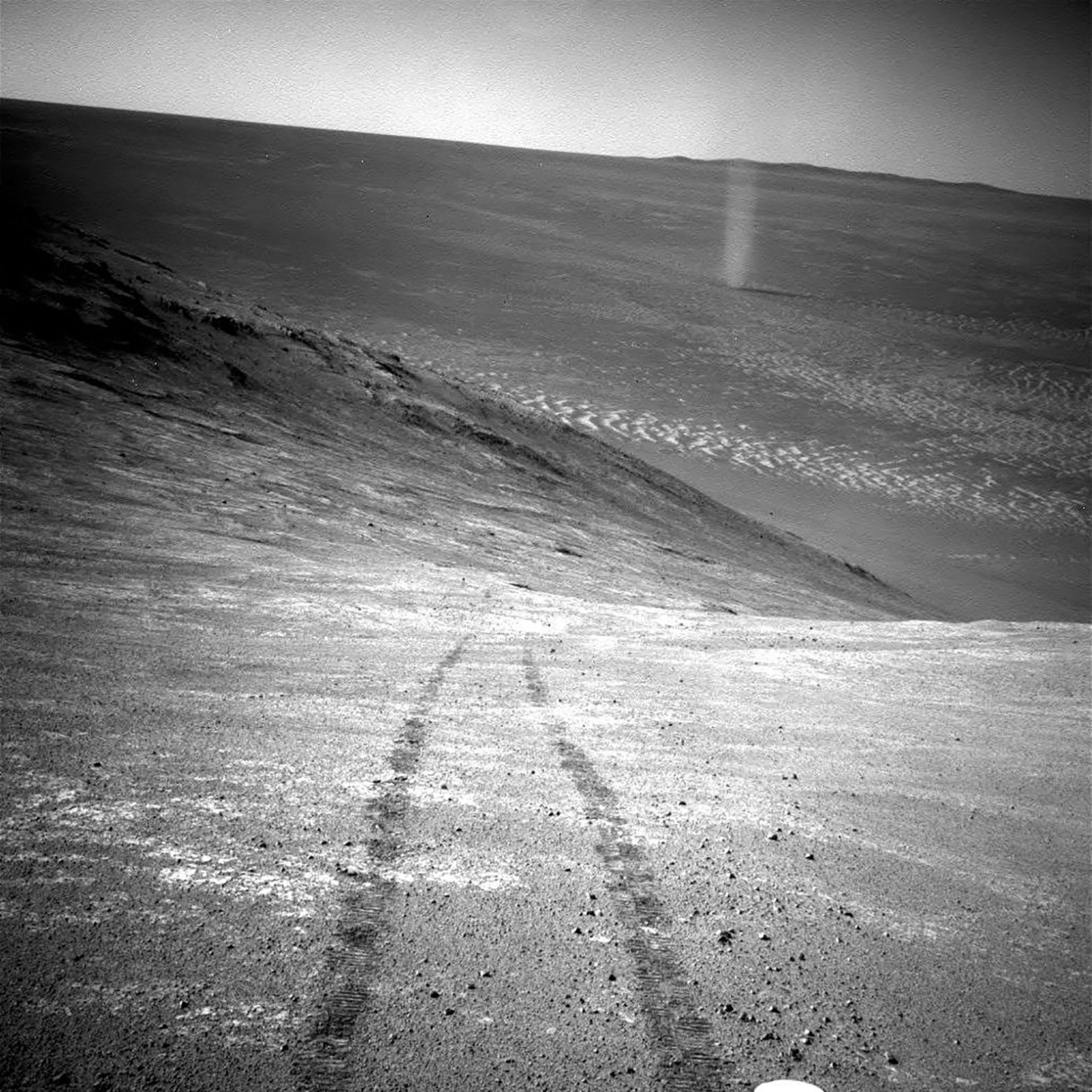
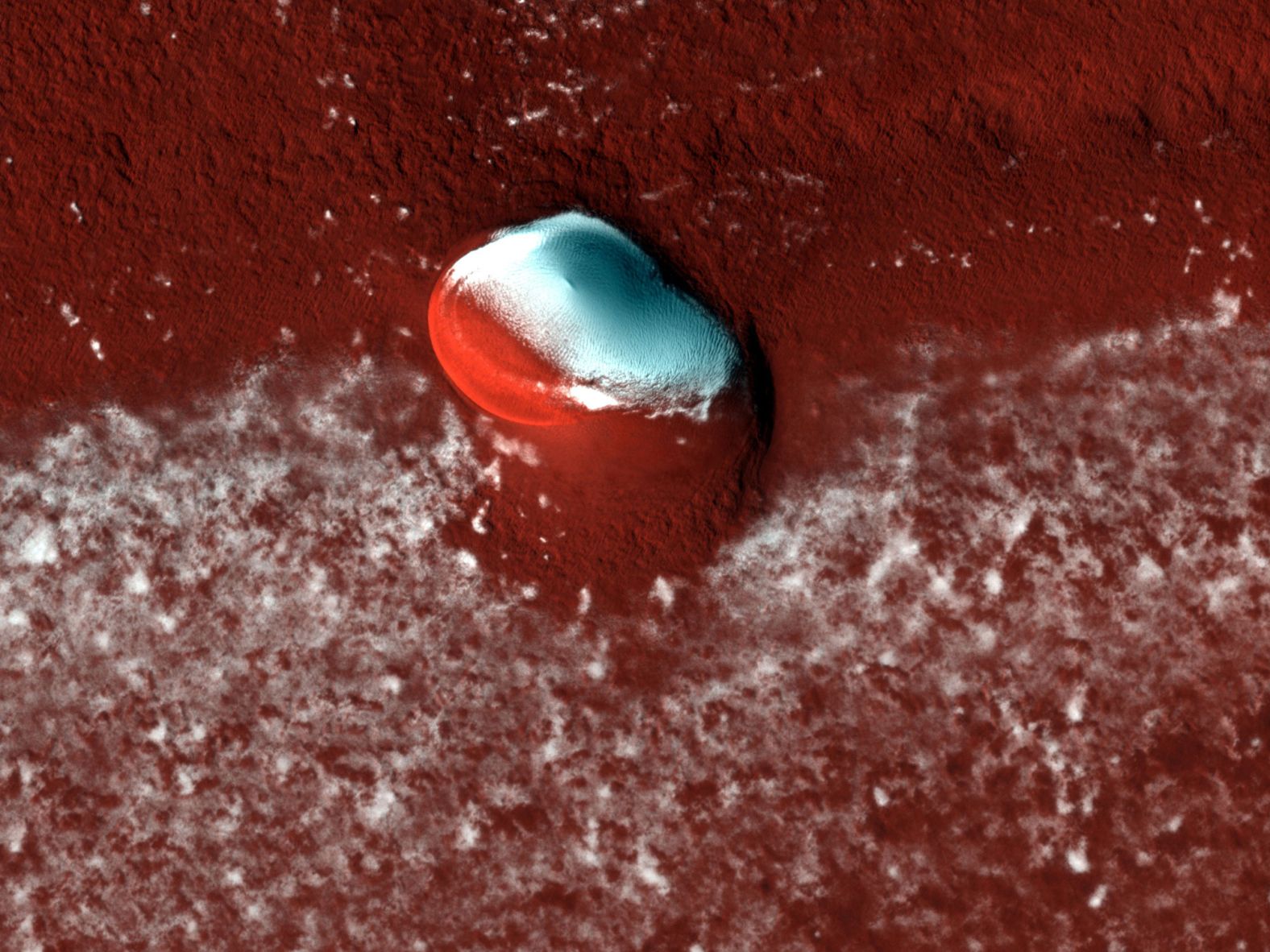
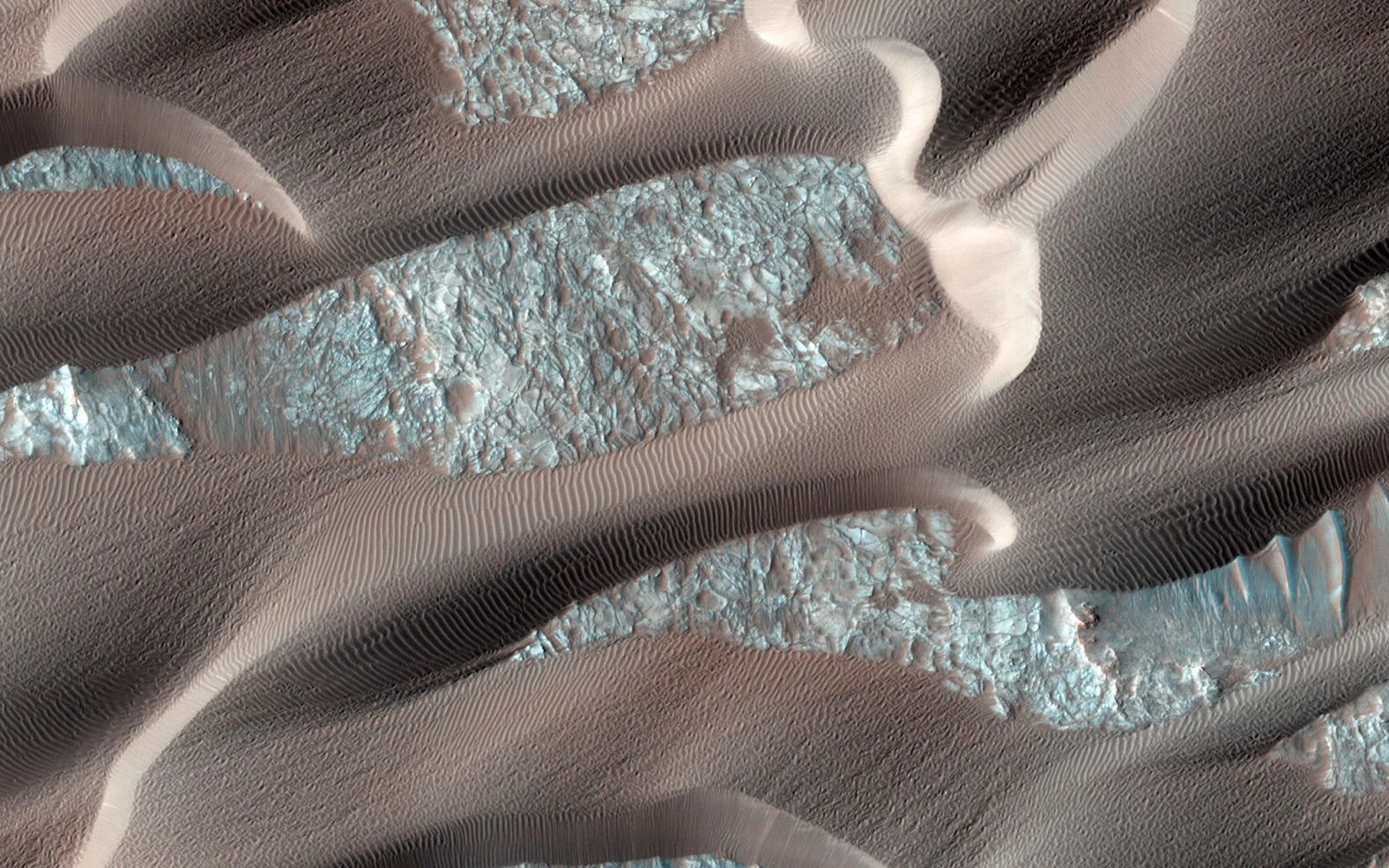
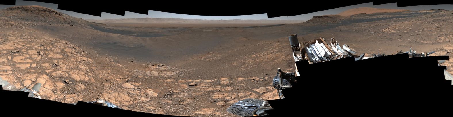
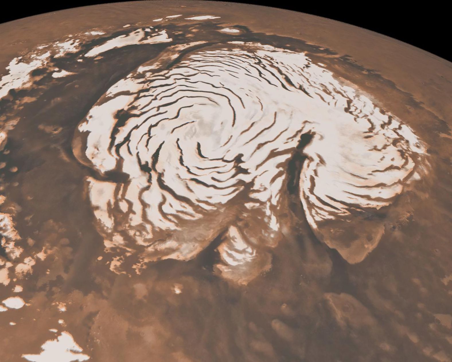
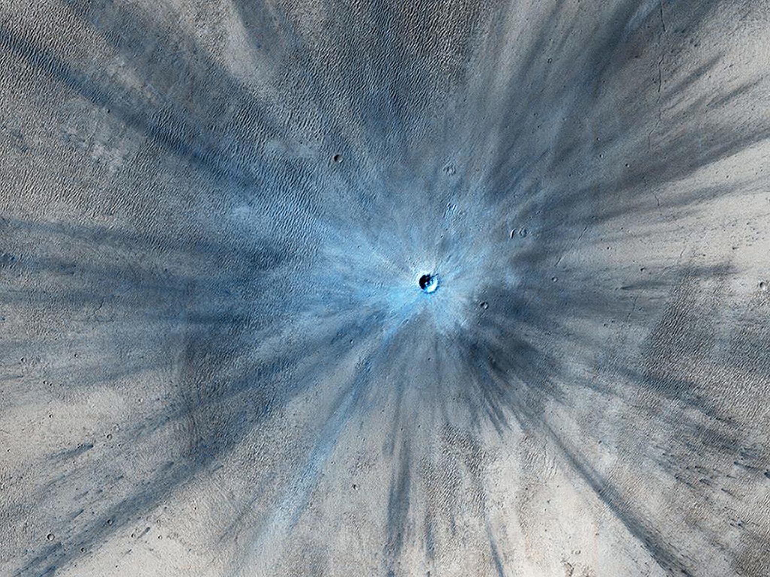
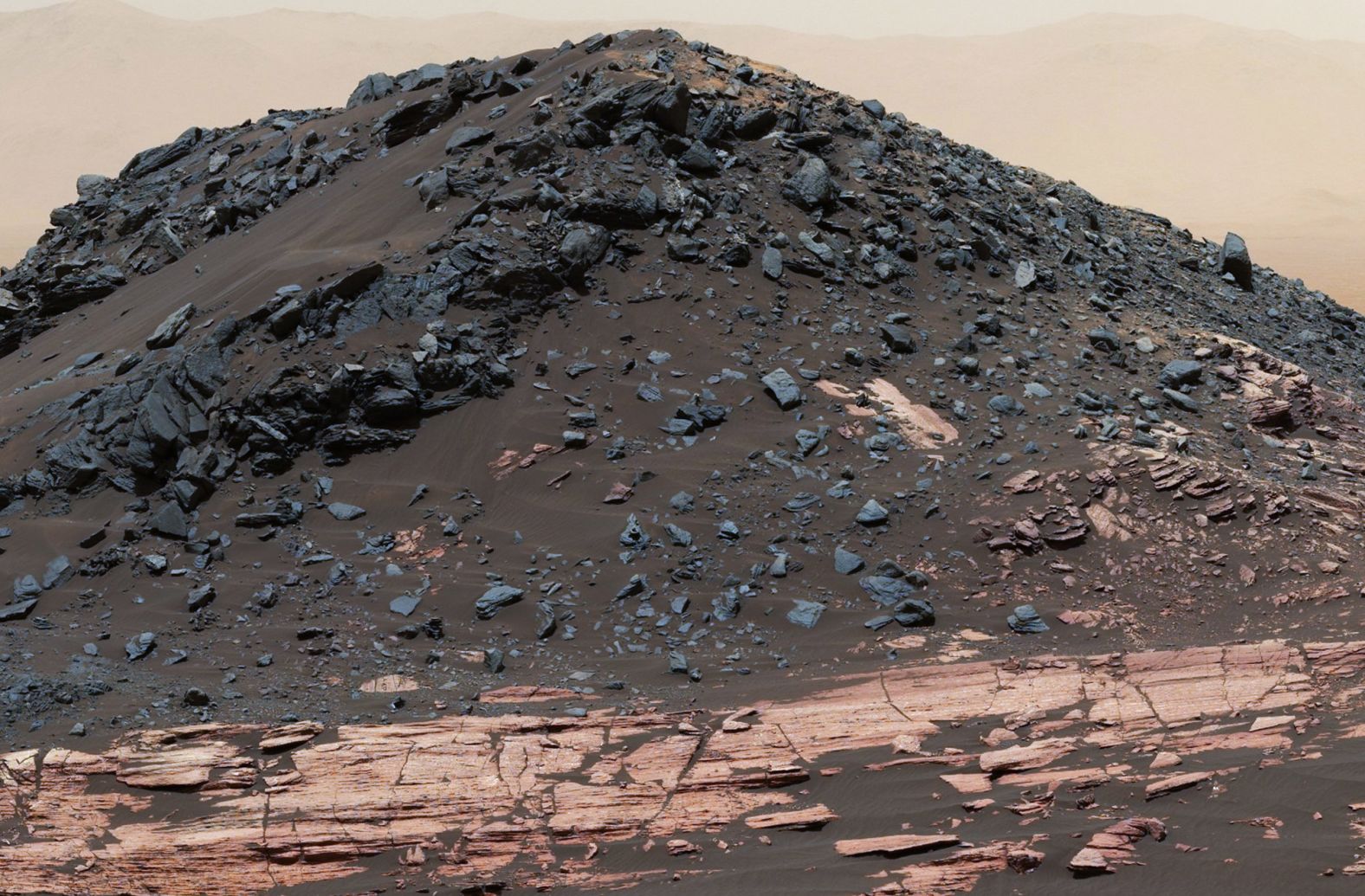
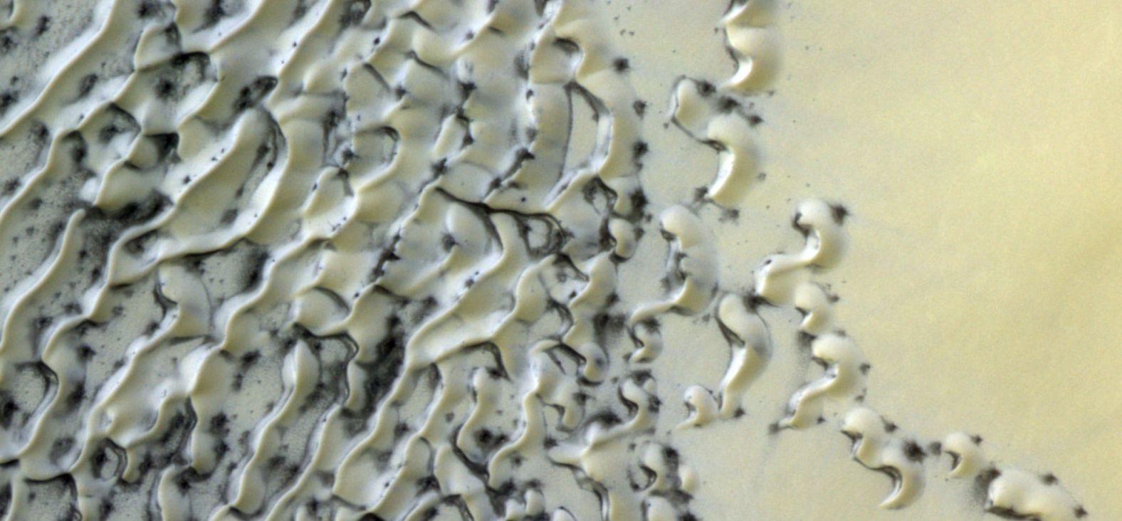
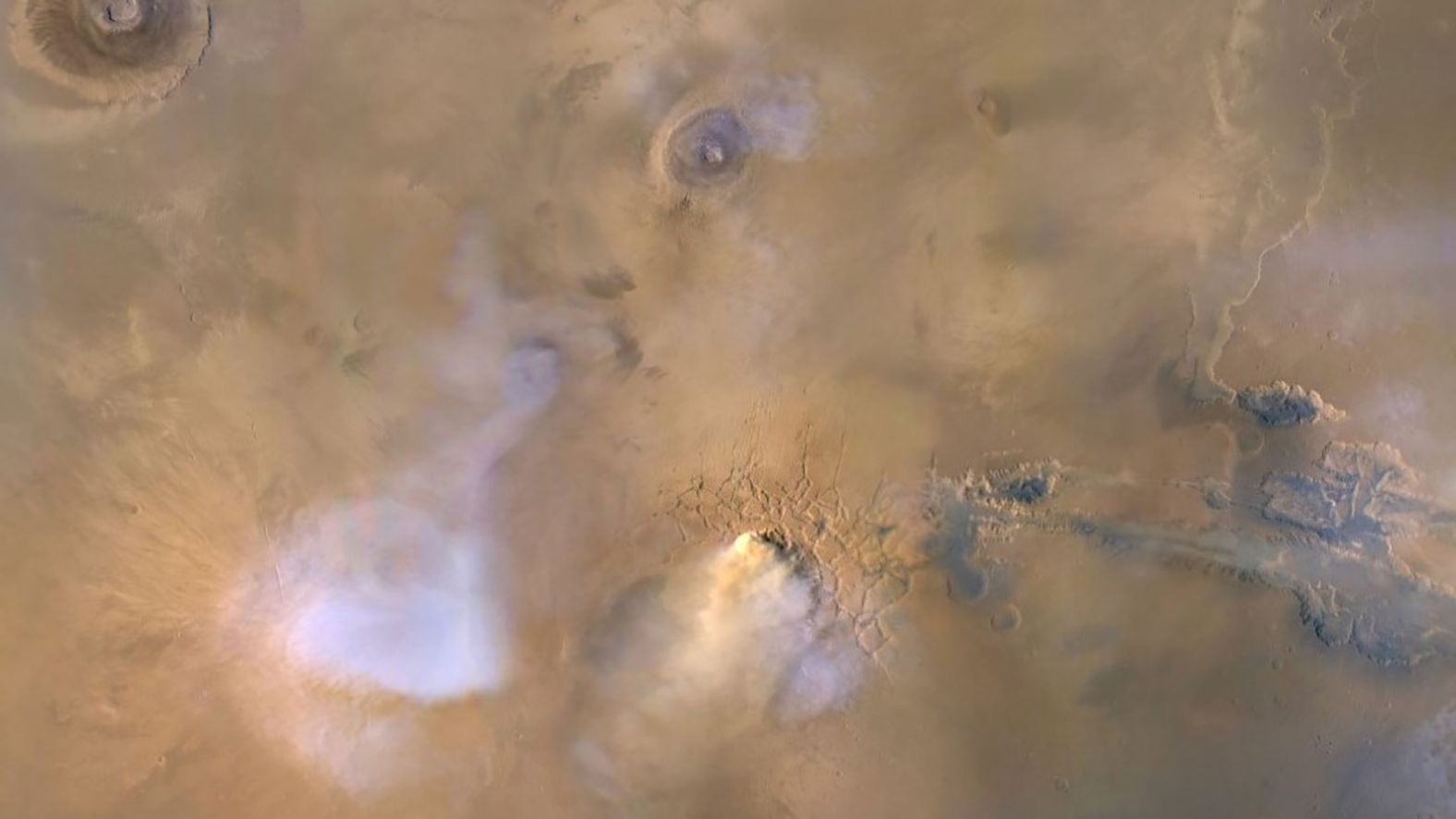
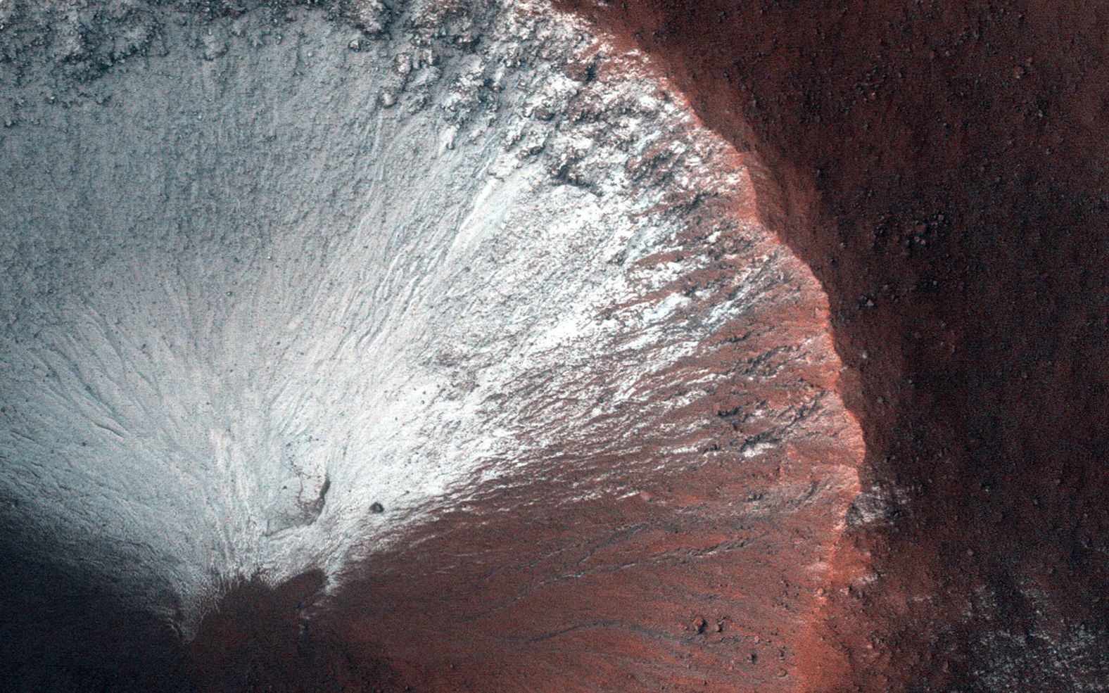
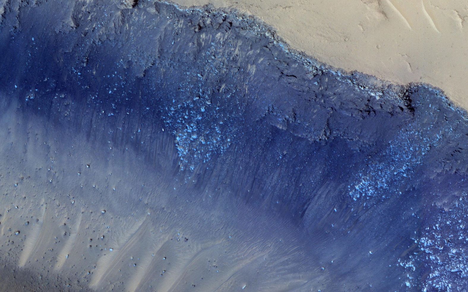
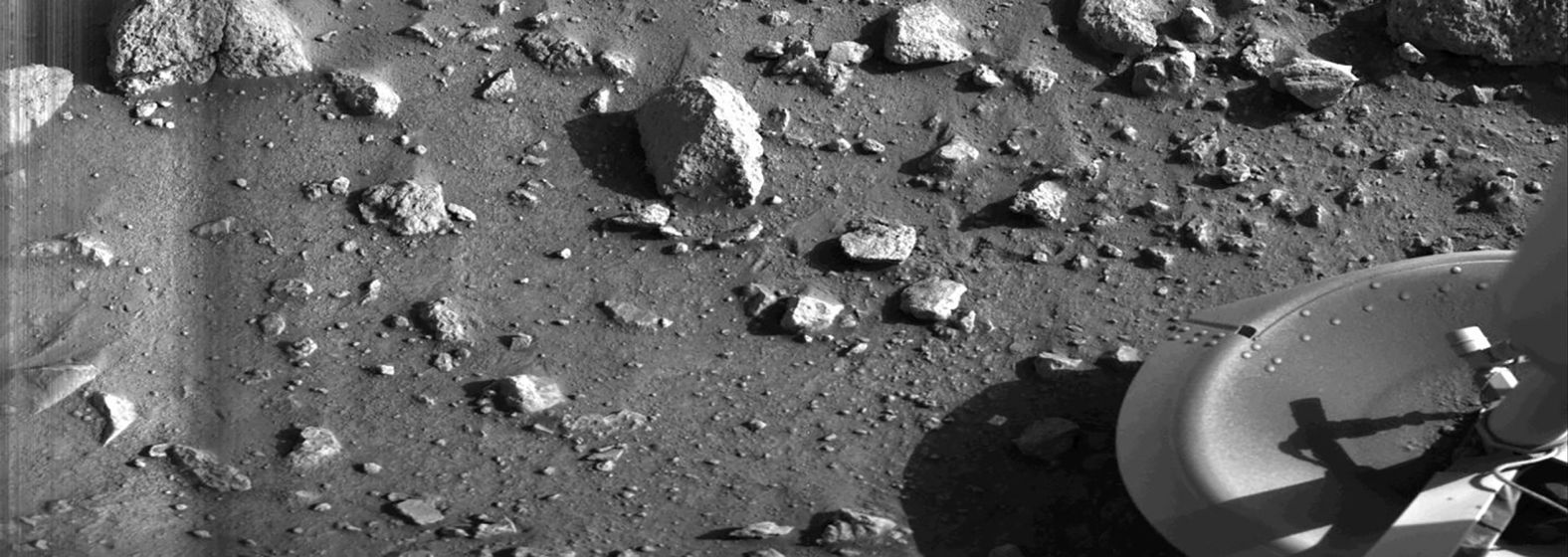
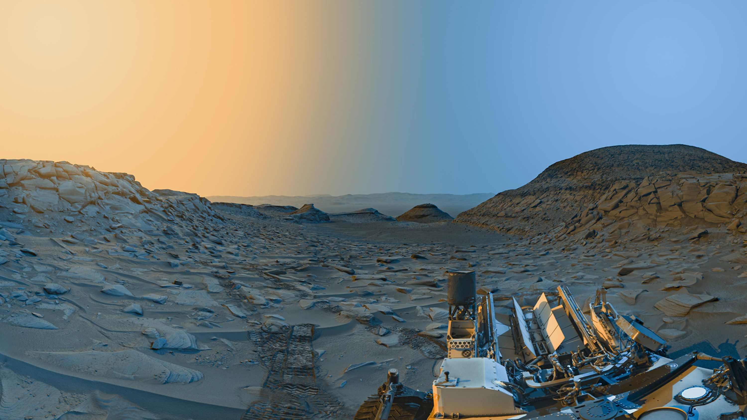
A fleet of robotic explorers orbit around and trek across the surface of Mars each day, capturing stunning new images.
Orbiters whirl around Mars, spying intriguing surface features, while rovers conduct up-close inspections of rock formations that could reveal more about the Martian past.
Together, these missions showcase the red planet like we've never seen it before.

The face of a bear appears to take shape on the Martian surface in this new image taken by the HiRISE camera aboard the Mars Reconnaissance Orbiter. Two craters create the eyes, a circular fracture shapes the face, and a V-shaped collapse structure represents the nose.
NASA/JPL-Caltech/UArizona

The Curiosity rover discovered this rock, smaller than a penny, that resembles a flower or piece of coral within Gale Crater on February 24. The small pieces in this photo were created billions of years ago when minerals carried by water cemented the rock.
NASA/JPL-Caltech/MSSS

NASA's Curiosity rover used two cameras to create this selfie in front of "Mont Mercou," a rock formation that stands 20 feet tall.
JPL-Caltech/MSSS/NASA

The Ingenuity helicopter captured this color image of Mars from 16 feet above the planet's surface in April 2021. It's the first color image ever taken during flight by a rotorcraft on Mars.
JPL-Caltech/NASA

This perspective of Mars' Valles Marineris hemisphere, from July 9, 2013, is actually a mosaic comprising 102 Viking Orbiter images. At the center is the Valles Marineris canyon system, over 2,000 kilometers long and up to 8 kilometers deep.
JPL-Caltech/NASA

This 2016 self-portrait of the Curiosity Mars rover shows the vehicle at the Quela drilling location in the Murray Buttes area on lower Mount Sharp.
JPL-Caltech/MSSS/NASA

This photo of a preserved river channel on Mars was taken by an orbiting satellite, with color overlaid to show different elevations. Blue is low and yellow is high.
NASA

The European Space Agency's Mars Express mission captured this 2018 image of the Korolev crater, more than 50 miles across and filled with water ice, near the north pole.
ESA/DLR/FU Berlin

The Mars Reconnaissance Orbiter used its HiRISE camera to obtain this view of an area with unusual texture on the southern floor of Gale Crater.
NASA/JPL-Caltech/Univ. of Arizona

Cooled lava helped preserve a footprint of where dunes once moved across a southeastern region on Mars. But it also looks like the "Star Trek" symbol.
NASA

Although Mars isn't geologically active like Earth, surface features have been heavily shaped by wind. Wind-carved features such as these, called yardangs, are common on the red planet. On the sand, the wind forms ripples and small dunes. In Mars' thin atmosphere, light is not scattered much, so the shadows cast by the yardangs are sharp and dark.
JPL-Caltech/University of Arizona/NASA

These small, hematite-rich concretions are near Fram Crater, visited by NASA's Opportunity rover in April 2004. The area shown is 1.2 inches across. The view comes from the microscopic imager on Opportunity's robotic arm, with color information added from the rover's panoramic camera. These minerals suggest that Mars had a watery past.
JPL-Caltech/Cornell/USGS/NASA

This image shows seasonal flows in Valles Marineris on Mars, which are called recurring slope lineae, or RSL. These Martian landslides appear on slopes during the spring and summer.
NASA/JPL-Caltech/Univ. of Arizona

Mars is known to have planet-encircling dust storms. These 2001 images from NASA's Mars Global Surveyor orbiter show a dramatic change in the planet's appearance when haze raised by duststorm activity in the south became globally distributed.
JPL-Caltech/MSSS/NASA

This composite image, looking toward the higher regions of Mount Sharp, was taken in September 2015 by NASA's Curiosity rover. In the foreground is a long ridge teeming with hematite. Just beyond is an undulating plain rich in clay minerals. And just beyond that are a multitude of rounded buttes, all high in sulfate minerals. The changing mineralogy in these layers suggests a changing environment in early Mars, though all involve exposure to water billions of years ago.
JPL-Caltech/MSSS/NASA

InSight's seismometer recorded a "marsquake" for the first time in April 2019.
NASA/JPL-Caltech

From its perch high on a ridge, Opportunity recorded this 2016 image of a Martian dust devil twisting through the valley below. The view looks back at the rover's tracks leading up the north-facing slope of Knudsen Ridge, which forms part of the southern edge of Marathon Valley.
JPL-Caltech/NASA

HiRISE captured layered deposits and a bright ice cap at the Martian north pole.
JPL-Caltech/Univ. of Arizona/NASA

Nili Patera is a region on Mars in which dunes and ripples are moving rapidly. HiRISE, onboard the Mars Reconnaissance Orbiter, continues to monitor this area every couple of months to see changes over seasonal and annual time scales.
JPL-Caltech/Univ. of Arizona/NASA

NASA's Curiosity rover captured its highest-resolution panorama of the Martian surface in late 2019. This includes more than 1,000 images and 1.8 billion pixels.
NASA/JPL-Caltech/MSSS

This image, combining data from two instruments aboard NASA's Mars Global Surveyor, depicts an orbital view of the north polar region of Mars. The ice-rich polar cap is 621 miles across, and the dark bands in are deep troughs. To the right of center, a large canyon, Chasma Boreale, almost bisects the ice cap. Chasma Boreale is about the length of the United States' famous Grand Canyon and up to 1.2 miles deep.
JPL-Caltech/MSSS/NASA

A dramatic, fresh impact crater dominates this image taken by the HiRISE camera in November 2013. The crater spans approximately 100 feet and is surrounded by a large, rayed blast zone. Because the terrain where the crater formed is dusty, the fresh crater appears blue in the enhanced color of the image, due to removal of the reddish dust in that area.
JPL-Caltech/Univ. of Arizona/NASA

This dark mound, called Ireson Hill, is on the Murray formation on lower Mount Sharp, near a location where NASA's Curiosity rover examined a linear sand dune in February 2017.
NASA/JPL-Caltech/MSSS

Is that cookies and cream on Mars? No, it's just polar dunes dusted with ice and sand.
CaSSIS/ESA/Roscosmos

The cloud in the center of this image is actually a dust tower that occurred in 2010 and was captured by the Mars Reconnaissance Orbiter. The blue and white clouds are water vapor.
MSSS/JPL-Caltech/NASA

HiRISE took this image of a kilometer-size crater in the southern hemisphere of Mars in June 2014. The crater shows frost on all its south-facing slopes in late winter as Mars is heading into spring.
JPL-Caltech/University of Arizona/NASA

The two largest quakes detected by NASA's InSight appear to have originated in a region of Mars called Cerberus Fossae. Scientists previously spotted signs of tectonic activity here, including landslides. This image was taken by the HiRISE camera on NASA's Mars Reconnaisance Orbiter.
JPL-Caltech/University of Arizona/NASA

This image is the first photograph ever taken from the surface of Mars. It was taken on July 20, 1976, by the Viking 1 lander shortly after it touched down on the planet.
NASA